


Hiking Education Guide
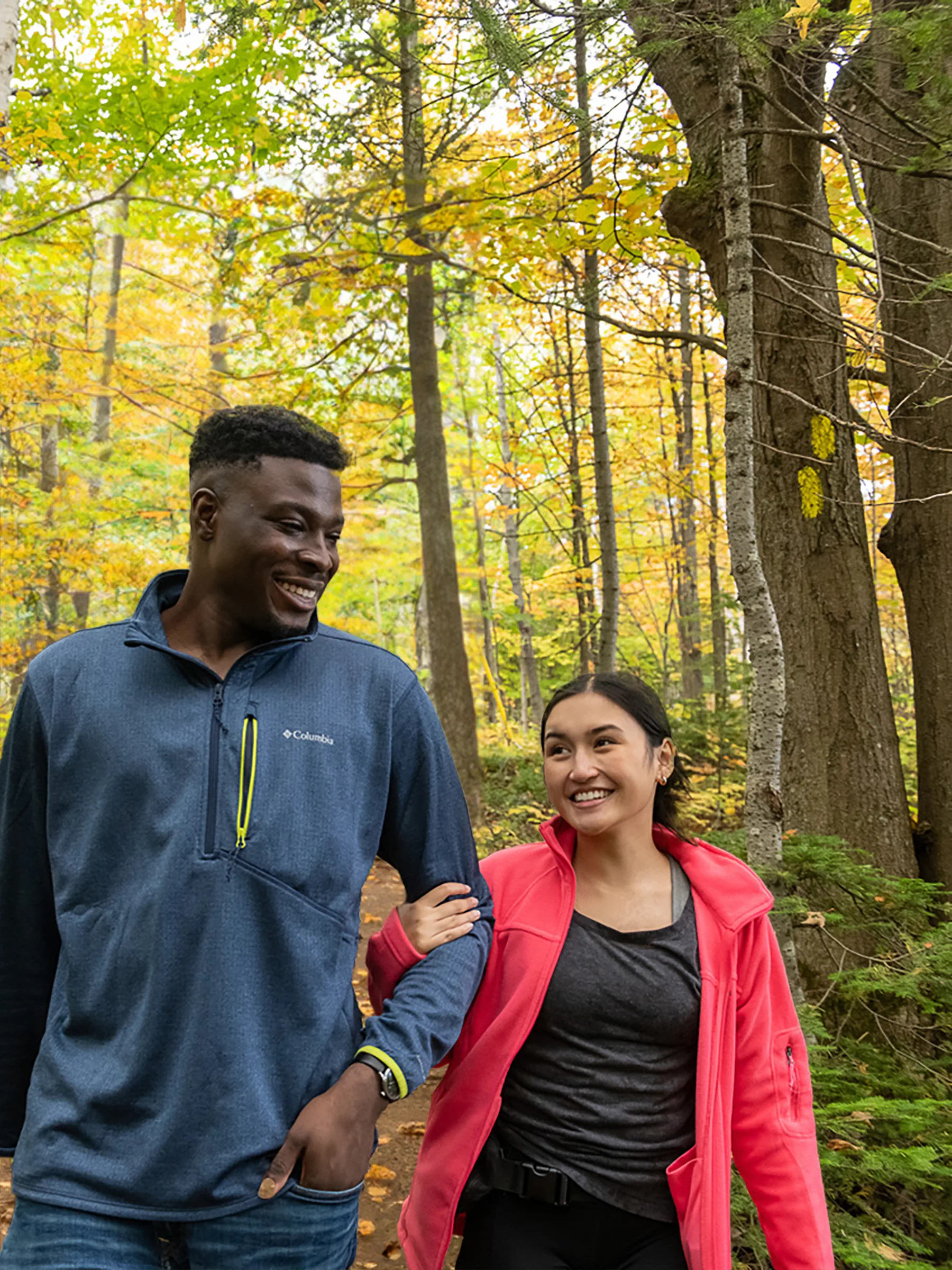
Explore with ConfidenceWhether you're a seasoned hiker or a first-time trailblazer, this guide will equip you with the essential knowledge and safety information you need to enjoy your day on the trails at Blue!
rich-text, responsive-tableBe Prepared
Don't Forget the Essentials
Proper Footwear

Enough Water
Know Before You Go
Everything you need to know about Blue Mountain trails so you can hike or bike with confidence
Trail Heads
These signs represent the starting point for one or multiple trails, provide details about these trails, and may also list connected trails.

Confirmation Points

Blazes
Blaze Colours at Blue Mountain
 rich-text, responsive-table
BLUE
Multi-Use Trails
These trails can be used for biking and hiking, use caution and share the trail.
PURPLE
Main Hiking Trails
These trails are exclusively for hiking and are point-to-point hikes. Plan to hike back along the same trail, complete another trail on your way back, or take the Open-Air Gondola to return.
YELLOW
Side Trails & Connecting Trails
These trails connect two or more other trails together.
ORANGE
Hiking Loop Trails
These trails form a loop where the start of the trail is also the end point.
WHITE
Bruce Trail
The Bruce Trail is Canada's oldest and longest marked hiking trail. The entire trail is more than 890km long with over 400 associated side trails and stretches from the Niagara River to the top of the Bruce Peninsula in Tobermory, Ontario. A 2km section of this trail cuts along the top of Blue Mountain.
Decoding Blazes
Paying attention to blazes provides critical information to help you find your way along a trail.
Trail Start

Straight Ahead

Left Turn

Right Turn

Intersection

Trail End

Staying on Trail
If the path is straightforward, blazes may be spaced further apart. If the path ahead is not obvious, blazes will be visible one after another. while most blazes are painted on trees and fence posts, you may find some blazes on wood stakes when crossing open spaces. If you lose the trail, return to where you last saw a blaze and look carefully for the next blaze. Always follow proper blazes and stay off closed sections of trail.
rich-text, responsive-table
Trail Designation
Explore Park Trails at Blue Mountain share the meaning of their designations with ski runs. The steeper the trail, the rougher the terrain, the harder it is to hike or bike.
Green Circle: Beginner
These trails are considered easy to walk, hike or bike and are beginner and family friendly. These trails may be paved, are mostly wide, and have limited changes in elevation and terrain.
rich-text, responsive-table
Blue Square: Intermediate
These trails are considered moderately difficult to hike or bike for an adult with a moderate level of fitness. There will be some sections with steep or rocky terrain with moderate changes in elevation.
rich-text, responsive-table


Black Diamond: Advanced
These trails are considered challenging to hike or bike for an adult with a moderate level of fitness. Trails may be rough and steep throughout and may be rocky and muddy. Suitable hiking shoes or boots are recommended.
rich-text, responsive-table
Get to Know
the Trail
DIRECTION
Blue Mountain has five mountain areas: Orchard, South, Village, Valley, and North. While hiking, you will either be travelling in the direction of the mountain base/bottom or the summit/top in one of these areas.
DISTANCE
The length of a trail at Blue is measured between decision points. The distance between these points is indicated in kilometres. Most trails are between one and two kilometres in length but may connect to other trails before reaching the summit or base.
TIME
The time to hike each section will vary based on trail difficulty and hiking speed. Hiking at an average speed, you should plan for around one hour of hiking to cover 5km of distance.
ELEVATION GAIN
Elevation gain is the vertical gain or loss from the start of the trail to the end. At Blue Mountain, vertical gain or loss is indicated on trail head signs and on-trail on confirmation signs. The higher the number, the steeper the trail.
Local Fauna
Blue Mountain is situated in a diverse natural environment that supports a variety of wildlife. This includes various birds, insects, mammals, amphibians and reptiles.-
White-Tailed Deer
rich-text, responsive-table
Keep an eye out for these mammals grazing in open fields or moving through the forested areas. Be quiet and give them space so as not to spook them.carousel-component
Always give wildlife enough space and do not attempt to approach, touch, hold, or feed animals. Report any aggressive or concerning animal presence or behaviour to Mountain Patrol.
rich-text, responsive-table -
Red FoxBlue is home to a number of red foxes. While shy and elusive, the best place to spot them is near Woodview Activity Centre. Their distinctive red fur and bushy tails make them stand out.
rich-text, responsive-tablecarousel-component
Always give wildlife enough space and do not attempt to approach, touch, hold, or feed animals. Report any aggressive or concerning animal presence or behaviour to Mountain Patrol.
rich-text, responsive-table -
Racoon
Nocturnal and highly adaptable, raccoons are common in both urban and natural environments. During the day, you may see them sleeping in the trees.
rich-text, responsive-tablecarousel-component
Always give wildlife enough space and do not attempt to approach, touch, hold, or feed animals. Report any aggressive or concerning animal presence or behaviour to Mountain Patrol.
rich-text, responsive-table -
Eastern Gray Squirrel
A familiar sight in the region, gray squirrels and chipmunks are arboreal rodents often seen darting through trees or foraging for food on the forest floor.
rich-text, responsive-tablecarousel-component
Always give wildlife enough space and do not attempt to approach, touch, hold, or feed animals. Report any aggressive or concerning animal presence or behaviour to Mountain Patrol.
rich-text, responsive-table -
Cottontail Rabbit
These rabbits are well adapted to life in this region. They are often seen in meadows eating and along the edges of wooded areas and are mostly active between dusk and dawn.
rich-text, responsive-tablecarousel-component
Always give wildlife enough space and do not attempt to approach, touch, hold, or feed animals. Report any aggressive or concerning animal presence or behaviour to Mountain Patrol.
rich-text, responsive-table -
Eastern Garter Snake
Non-venomous and harmless, garter snakes are black with yellow stripes and commonly found in the region. They play a crucial role in controlling insect populations.
rich-text, responsive-tablecarousel-component
Always give wildlife enough space and do not attempt to approach, touch, hold, or feed animals. Report any aggressive or concerning animal presence or behaviour to Mountain Patrol.
rich-text, responsive-table -
Red-Tailed Hawk
Look to the skies see raptors including Red-tailed Hawk soaring overhead. They often perch on high vantage points, such as utility poles or trees, while searching for prey.
rich-text, responsive-tablecarousel-component
Always give wildlife enough space and do not attempt to approach, touch, hold, or feed animals. Report any aggressive or concerning animal presence or behaviour to Mountain Patrol.
rich-text, responsive-table -
Wild Turkey
Wild Turkeys are large birds with a distinctive fan-shaped tail and a bare, wattled head. These social birds often form flocks, and you may spot them in open spaces and along the tree line.
rich-text, responsive-tablecarousel-component
Always give wildlife enough space and do not attempt to approach, touch, hold, or feed animals. Report any aggressive or concerning animal presence or behaviour to Mountain Patrol.
rich-text, responsive-table


Stay Clear of These Plants
It's essential for hikers and outdoor enthusiasts to be aware of potential poisonous or noxious plants. To ensure a safe hiking experience, familiarize yourself with the appearance of these plants and exercise caution when exploring natural areas.
rich-text, responsive-tablerich-text, responsive-table

Poison Ivy

Wild Parsnip

Giant Hogweed

Stinging Nettle

Trail Etiquette
Hike to the least experienced hiker's ability.
Leave what you find. Do not remove natural resources from the trails including rocks, fossils, nests, and other such items. Let other people enjoy them as you do.
To prevent damage to vegetation, stay on marked trails at all times.
Leave no trace. Pick up what you pack in to the trails including disposable cups, water bottles, wrappers and more. Garbage and recycling bins are located at the top and bottom of Blue Mountain for your use.

Leave No Trace

Safety
Tell a reliable person where you are going and when you expect to be back.
Dogs must be on-leash at all times.
Study trail descriptions and maps. Choose a trail suitable for the least experienced hiker in your group.
Stay on marked trails.
rich-text, responsive-table

rich-text, responsive-table
How do I access the trails?
You will need a day ticket or season pass to access the trails at Blue. Purchase in advance and pick up at Guest Services. You can also purchase tickets in person. Once you have your ticket, you can access the trails from any Trail Head at the base or top of the mountain. You can access the Mountaintop via the Open-Air Gondola or by hiking up.
To locate a Trail Head, look for a the numbers with a white circle in a black square on your map. Some trail heads may be hard to find so keep an eye out for well worn dirt paths and the large map signs.
How can I get a paper map?
For a paper map of the Explore Park, please visit Guest Services.
What do I do if I get lost or hurt?
If you experience an on-trail emergency, call Blue Mountain Patrol at 705-445-0231 x52900.
An on-trail emergency may include a medical emergency, missing person, serious injury or accident, or inability to return to base. Please hike within the ability level of your group and avoid dangerous situations.
If you are lost but your situation is not an emergency, retrace your steps or use the Blue Mountain App to navigate back to the base or Open-Air Gondola.
To avoid getting lost, stay on marked trails. If you do not have a map, consider taking a photo of the map at the Trail Head. If you are unsure you are still on-trail, look for a blaze and go to it, continuing following the blazes to the end of the trail.
How do I prepare for a hike?
Here are some things you can do to prepare for a hike at Blue:
- Wear appropriate hiking shoes/boots and comfortable, weather appropriate clothing
- Purchase a day ticket or season pass
- Download the Blue Mountain App for trail maps and to track your hike
- Bring a water bottle and snacks
- Wear a backpack or fanny pack to carry out any garbage
- Stretch and hike within the ability of the slowest person in your group
Where can I buy hiking shoes, clothing, or accessories?
Forgot something? You can purchase hiking footwear, clothing and accessories in the Blue Mountain Village at Red Devil Sports, Columbia Sportswear, or other great stores.
How will I know where I am when I'm hiking?
Trails begin at a Trail Head sign and end at another Trail Head sign. On trail, you will see frequent blazes and signs to indicate you are still on trail. You will find Confirmation signage at intersections where you can continue on the trail you are on or follow another trail to the base or summit.
The location of Trail Head and Confirmation signs are indicated on all maps using the number on the tops of these signs. To know your exact location on a trail, download the Blue Mountain App and track your hike.
What can I do after my hike?
Finishing your hike at the Mountaintop? We recommend an ice cream or cold drink from the Coca-Cola Concession or a sit down meal at Summitview Restaurant before an Open-Air Gondola ride down to the base.
Finishing your hike at the base? Use your day ticket to access attractions in the Adventure Park or enjoy an ice cream or cold drink from Chill Seeker Snack Bar. Visit the shops and restaurants in the Blue Mountain Village or cool off with a swim at Plunge! Aquatic Centre.


